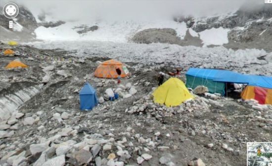
Google Street View photos on Mount Everest, this is the southern side of Everest located in Nepal.
According to news from Beijing time on March 19th early morning, Google announced on Monday that it has added 360-degree Street View imagery of the world’s highest peak, Mount Everest, to Google Maps.
Over the past year and a half, Dan Fredinburg, a member of Google's privacy and security team, spent his spare time climbing the world’s most famous mountains to help the company add Street View imagery of these peaks to Google Maps.
In addition to the two aforementioned mountains, Fredinburg has also climbed Aconcagua in South America (the highest peak in the Western Hemisphere). In a phone interview with ABC News, he said: “I led a team of Google colleagues to climb these peaks in order to make Google Maps more enriching and adventurous.”
Fredinburg and his “Mountain Enthusiast” team carried two cameras and a fisheye lens during their climbs, as well as lightweight tripods. According to him, Google’s wearable Street View camera system Trekker was too heavy and bulky for mountaineering use.
The team took photos in various directions to create a 360-degree view. Fredinburg explained that they took three photos in each of the four cardinal directions—east, south, west, and north—and then used software to “stitch” the images together to create a 360-degree perspective.
Users can simply search for keywords such as Mount Everest, Kilimanjaro (Africa’s highest peak), and Aconcagua to view the 360-degree Street View imagery of these peaks.
Over the past few months, Google has added several creative Street View images to its maps, including photos of the Grand Canyon in Colorado, USA, and some large football stadiums.