Hiking just got easier with Pingtung County’s handpicked “Ten Scenic Trails”!
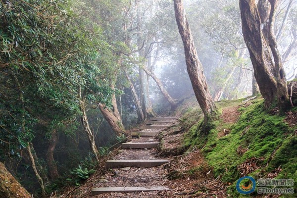
▲ The Xiduo Cliff of Beidawushan Trail (Photo provided by the Pingtung County Government Tourism and Communication Division; all subsequent photos are from the same source)
By Travel Center / Comprehensive Report
Hiking has become a popular leisure activity for many, and to provide more information on hiking options, Pingtung County Government has specially compiled a collection of the area’s forest gems. It has produced a hiking guide brochure that features10 “Ten Scenic Trails”, not only detailing the unique features of each scenic spot and the best hiking seasons, but also categorizing the trails by difficulty level.
The Pingtung County Government Tourism and Communication Division stated that these 10 “Ten Scenic Trails” each have their own characteristics. They include Weiliao Mountain, known as one of the Minor Hundred Peaks, Beidawushan where the county government holds its coming-of-age ceremonies, and the newly popular AxQ Yi Ancient Trail. The 10 trails stretch from Weiliao Mountain in Gaoshu Township, the northernmost part of Pingtung, all the way south. Here is an introduction to the 10 “Ten Scenic Trails.”
1. Gaoshu Township Weiliao Mountain Trail
Weiliao Mountain is located at the border between Sanmin Township in Pingtung and Maolin Township in Kaohsiung. The first half of the trail is a gentle slope along a service road, while the second half becomes a proper mountain path. The trail is long and steep, making it a challenging Minor Hundred Peak route.
Location: Gaoshu Township, Pingtung County; Sanmin Township, Pingtung County; Maolin District, Kaohsiung City
Entrance: Gaoshu Township, Pingtung County
Total Length: Approximately 9.5 km one way (to the summit triangulation station of Weiliao Mountain)
Elevation: 200–1,430 meters
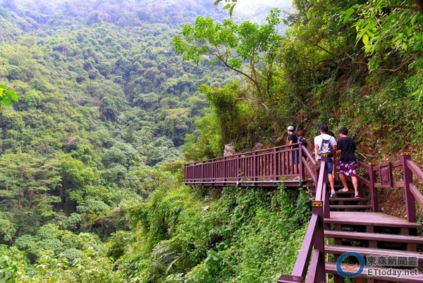
2. Maolin Township Liangshan Waterfall Trail
The Liangshan Waterfall Trail is located in the Niujiaowan Stream, an upper tributary of the Donggang River in Pingtung. The trail follows the stream uphill and passes three tiers of waterfalls. The area is rich in natural scenery, with the path hugging the mountain stream. Along the way, you’ll find rapids, deep pools, streambanks, and the soothing sound of flowing water—a refreshing sight perfect for a summer escape.
Location: Maolin National Scenic Area
Entrance: Liangshan Waterfall Parking Lot
Total Length: 2.1 km one way
Elevation: 93–221 meters
3. Taiwu Township Beidawushan Trail
Beidawushan is the last peak in the southern part of the Central Mountain Range with an elevation over 3,000 meters. It is one of Taiwan’s Five Great Mountains and is considered sacred by the local Paiwan people, who call it “Meli-miligang,” meaning “dreamlike beauty.” The mountain boasts Taiwan’s largest area of primeval forest, teeming with diverse wildlife.
Location: Taiwu Township, Pingtung County; Jinfeng Township, Taitung County
Entrance: Taiwu Township, Pingtung County
Total Length: 9 km
Elevation: 1,500–3,000 meters
4. Fangliao Township Jinsuiying Ancient Trail
The Jinsuiying National Trail starts in Shuibi Liao, Fangliao Township, Pingtung County, and ends at Jialopan Tribe in Daren Township, Taitung County. It is the ancient trail crossing the Central Mountain Range with the lowest pass, highest usage frequency, and longest period of use in Taiwan.
Location: Daren Township, Taitung County
Location: Daren Township, Taitung County
Entrance: Daren Township, Taitung County
Total Length: 15.4 km
Elevation: 200–1,450 meters
5. Shuangliu National Forest Recreation Area Trails in Shizi Township
Shuangliu gets its name from the confluence of two major tributaries of the Fenggang River that flow through the area. The streams bring ample moisture to the park, and during the rainy season, several seasonal waterfalls can be seen cascading down the cliffs. Sheltered in a wind-protected valley, the area boasts dense and diverse vegetation. It is rich in butterfly species in spring and summer, and in winter, it becomes a gathering spot for purple crow butterflies, making it an excellent butterfly-watching destination in southern Taiwan.
Location: Shizi Township, Pingtung County
Entrance: Shizi Township, Pingtung County
Total Length: Hillside Trail – 2 km, Banyan Trail – 1.9 km, Hat Mountain Trail – 2.7 km, Waterfall Trail – 3 km
Elevation: 150–650 meters
6. Lilongshan Trail in Checheng Township
Lilongshan, also known as Lilongshan, stands about 1,069 meters tall and is one of Taiwan’s Hundred Mountains under 1,000 Meters. It is an extension of the southern Central Mountain Range and the only mid-altitude mountain on the Hengchun Peninsula that exceeds 1,000 meters in elevation.
Location: Shizi Township, Pingtung County
Entrance: Fangshan Township, Pingtung County
Total Length: 7 km
Elevation: 200–1,050 meters
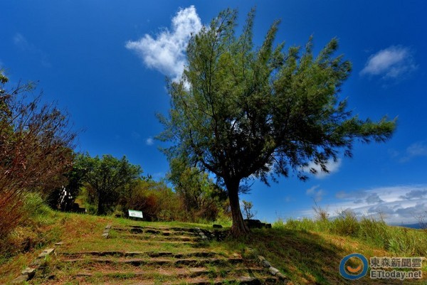
▲ Guishan Trail Entrance
7. Guishan Trail
Located next to the National Museum of Marine Biology and Aquarium in Sheliau Village, Checheng Township, Pingtung County, Guishan (Turtle Mountain) is named for its turtle-like shape. It features gentle hiking trails that take just over ten minutes to reach the summit. Though not high in elevation, it is the highest point in the Checheng area, offering sweeping views of the entire Hengchun Valley Plain.
Location: Checheng Township, Pingtung County
Entrance: Guishan Trailhead (Route 153, 2 km mark)
Total Length: 7 km
Elevation: 8–75 meters
8. Shimen Mountain Trail in Mudan Township
Shimen Mountain (also called Shimu Mountain), at approximately 384 meters above sea level, is shaded by trees along the way. It takes about half an hour to reach the viewing platform and around one hour to get to the summit trigonometric point. The final 200 meters near the top are very steep, almost requiring climbing. The trail offers views of Shimen Village and Sihchong Stream.
Location: Mudan Township, Pingtung County
Entrance: Mudan Township, Pingtung County
Total Length: 1.05 km
Elevation: 80–880 meters
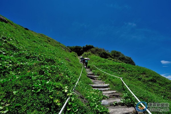
▲ View of AxQ One Brave Man Slope
9. AxQ One Ancient Trail
The A-Xi Ancient Trail is located between Nantian Village in Daren Township, Taitung County, and Shu Hai Village in Mudan Township, Pingtung County. It is the only remaining undeveloped coastal trail in Taiwan without any roads running through it. Stretching 8.4 kilometers in length, the trail boasts rich biodiversity and expansive views. At its highest point, you may even catch a glimpse of green sea turtles in action.
Location: From Nantian Village, Daren Township, Taitung County to Shu Hai Village, Mudan Township, Pingtung County
Entrance: Shu Hai Fishing Port Parking Lot (at the 88.6 km mark of Provincial Highway 26 in Nantian)
Total Length: 8.4 km
Elevation: 5–125 meters
10. Kenting National Forest Recreation Area
The Kenting Forest Recreation Area sits at an elevation of around 200–300 meters. Its limestone caves and tropical plant life are among the most spectacular in Taiwan. Notable sights include the Stone Bamboo Cave, Fairy Cave, the One-Line Sky, Ape Cliff, Labyrinth Forest, First Gorge, Banyan Valley, and Silver Dragon Cave. From higher vantage points, you can enjoy panoramic views of the mountains and sea, including Da Jian Mountain, the Taiwan Strait, and the Bashi Channel.
Location: Hengchun Town, Pingtung County
Entrance: Hengchun Town, Pingtung County
Total Length: 8.1 km
Elevation: 200–300 meters
This brochure categorizes hiking trails based on their gradient and terrain conditions, indicating the level of difficulty for each climb. It not only introduces the characteristics of each trail cluster, recommends routes, and shares safety tips but also provides detailed geographical locations, navigation maps, suggested hiking seasons for each trail, and local emergency contact information.
Pingtung County Hiking Guide Brochure
Quantity: 50,000 copies
Distribution Points: Free copies are available at the tourist service centers of Kaohsiung Railway Station, Kaohsiung International Airport, and the Zuoying High-Speed Rail Station, as well as at Pingtung Railway Station, Hengchun Transit Station, and the Pingtung County Government Service Counter.
Source of Trail Information:Taiwan Mountain Trails
Bored at work or school and longing for a trip?
Download the “ETtoday News Cloud APP” for a virtual travel experience →
iOS:https://goo.gl/rmIDdx
Android:https://goo.gl/XPe8Uj
Share
This article is published by HowToTrip. Sharing and reposting are welcome — please credit the source.
Article URL: https://www.howtotrip.net/views-9201
Related Articles
- Shaoxing's "Grandpa Gourd" hangs the gourds back up: "If there are too many people, we'll interact less — just take a quick look from afar"
- Chinese authorities announce "reciprocal adjustment" to Japan visa fees — single-entry visa jumps from 2,250 to 16,750 yen!
- The "health stones" carried by a traveler were found to have radiation levels exceeding safety limits by a thousand times, potentially endangering fellow passengers on the same flight. Customs issues warning!
- Shenzhen Airport Issues Late-Night Notice: Unidentified Aerial Object Detected, Causing Widespread Flight Delays!
- “They only said it cost money after I opened the box and washed it!” 200g of grapes sold for 60 yuan on a high-speed train—12306 responds!
- Can't buy an airline ticket? Denied exit? Blocked from boarding? A large number of Chinese tourists have mysteriously become "discredited individuals"
- Adverse weather and economic fluctuations impact Colombia's coffee market
- Beach bathing area responds to 2 yuan/30 seconds fee for freshwater foot rinsing: Clearly priced!
- Taking off with an improperly closed cabin door? Wing malfunction? Multiple flights made emergency returns mid-journey!
- Experience the gifts of nature! A countdown of the world’s ten most stunning coastlines