Top 10 Must-Visit Scenic Spots in Taiwan Voted by Public & Discover Hidden Natural Wonders
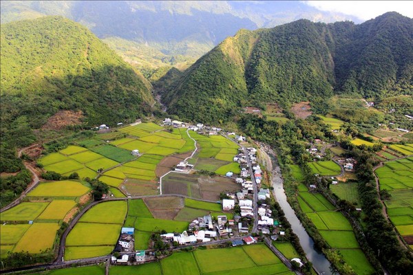
▲Taiwan’s unique geological background has created many naturally beautiful landscapes. The Forestry Bureau launched the Taiwan Top 10 Scenic Spots Voting Campaign to invite the public to choose iconic Taiwanese scenery. Pictured here is the "Turtle Creek Little Tianxiang Canyon Terrain" in Fuli Township, Hualien. (Photo / Courtesy of Taiwan Scenic Conservation Network)
Reported by Chen Tzu-yin / Taipei
The "Taiwan Top 10 Scenic Spots Voting Campaign," jointly organized by the Forestry Bureau of the Council of Agriculture and the Department of Geography at National Taiwan University, has seen fierce competition since its launch on August 15. The Forestry Bureau revealed,that the current top 40 list includes well-known attractions such as Yushan Main Peak, Sun Moon Lake, the mudstone badlands of Yehliu, and Yehliu Geopark, but there are also some highly potential spots yet to be discovered by the public. The voting deadline is September 15, and people across the country still have the chance to see their favorite scenic spots make it into the final top 10..
Taiwan’s unique geological development background has created a rich diversity of landscapes, nurturing a wide variety of biological and ecological resources. Many special landscapes are valuable natural assets protected under the Cultural Heritage Preservation Act. Since 2009, the Forestry Bureau has commissioned a scenic conservation research team, which spent four years completing the registration of 341 scenic conservation sites nationwide, evaluating 48 national-level and 293 local-level scenic spots. This voting campaign aims to help the public learn about the scenic resources in their own regions and vote for their top 10 favorite landscapes.
These top 10 scenic spots differ from typical tourist attractions, focusing more on conservation, environmental education, and scientific value. Beyond preservation, moderate scenic tourism or ecotourism integrated with local industries could be another viable path for local communities.
According to the Forestry Bureau, among the currently announced top 40 list, many are relatively famous or well-known tourist and hiking spots, while lesser-known scenic areas have received fewer votes. For example,the "Liji Badlands" in Beinan Township, Taitung, which hold national-level significance, feature a lunar-like landscape and are the outcrop where the Eurasian Plate and the Philippine Sea Plate collide.They contain complex faulted and sheared strata, a product of a plate convergence zone. With its matrix of sheared and deformed muddy sediments interbedded with a wide variety of foreign rock blocks of differing sizes, it is also known as the "Liji Mélange."

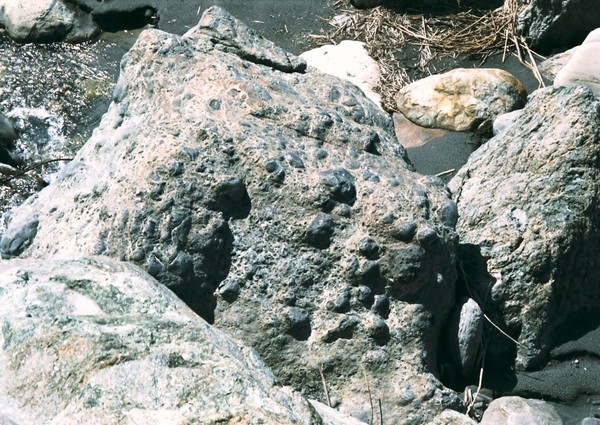
▲The "Liji Badlands" in Beinan Township, Taitung, showcase a lunar-like appearance as the collision zone between the Eurasian and Philippine Sea Plates, featuring complex faulting and shearing of strata as a product of the plate convergence zone. (Photo / Courtesy of Taiwan Scenic Conservation Network)
Plate boundaries are generally located deep in the ocean, so seeing them on land is extremely rare, making this an invaluable site for geologists from around the world to study plate collision. From a scientific perspective, it even holds the value of an international natural heritage site. The Liji Badlands face the "Beinan Mountain Conglomerate" (commonly known as Little Huangshan) across the Beinan River, and both landscapes can be viewed in their entirety from the observation deck in Fuyuan Village.
Other lesser-known scenic spots includethe "Caota Sand Dunes" in Dayuan District, Taoyuan (pronounced "Tuo" as in "tread"), which are a rare and well-developed group of sand dunes formed under the influence of the prevailing northeastern monsoon in northern Taiwan. The coastal dunes stretch spectacularly, making them one of Taiwan’s renowned sand dune formations.
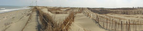
▲The "Caota Sand Dunes" feature spectacular stretches of coastal dunes. (Photo / Courtesy of Taiwan Scenic Conservation Network)
When driving along National Highway 6 in Nantou, you’re bound to seethe "Jiujue Peak Nature Reserve" and the "Wushalan Layer Outcrop of the Wu River in Wufeng, Taichung." The exposed rock walls along the Wu River often catch the eyedue to the differing resistance to erosion between sandstone and shale, combined with the tilting of rock layers, forming undulating mountain ridges known as hogback terrain. Looking across the Wu River from its southern bank, you can see ridge-like mountains stretching approximately 2,500 meters.
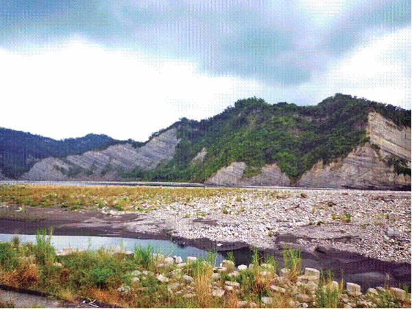
▲The Wushalan Layer outcrop along the Wu River features ridge-like mountains stretching about 2,500 meters. (Photo / Courtesy of Taiwan Scenic Conservation Network)
Additionally,from the Wuling Farm ticket gate to the Wanshou Bridgehead, you’ll often see a large, roughly triangular rock wall on the right — this is the "Wuling Meixi Sandstone Outcrop" scenic area,which is nearly vertical due to the intense effects of orogeny that tilted originally horizontal rock layers to near-vertical positions.
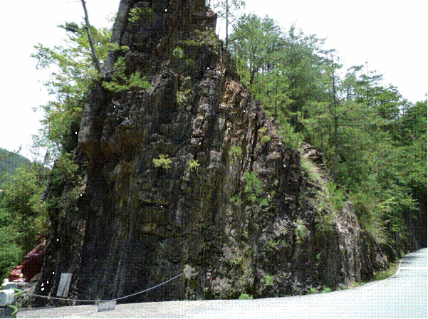
▲The Wuling Meixi Sandstone Outcrop scenic area features rock layers tilted nearly vertical due to orogenic forces. (Photo / Courtesy of Taiwan Scenic Conservation Network)
The "Turtle Creek Little Tianxiang Canyon Terrain and Cultural Landscape" in Fuli Township, Hualien, is a composite asset that includes both cultural and natural landscapes, blending harmoniously with canyons, river terraces, terraced fields, and irrigation channels.It is also home to the Jihala’ai Tribe, where the local Amis people make their livelihood.

▲The Turtle Creek Little Tianxiang Canyon Terrain features a harmonious blend of canyons, river terraces, terraced fields, and irrigation channels. (Photo / Courtesy of Taiwan Scenic Conservation Network)
Located in the northernmost part of the country, Dongyin Island of Matsu is relatively unknown due to its inconvenient transportation, but the island boasts rich landscapes, including the "One-Line Sky and Lie Nu Yi Pit," two nearby scenic spots.Although both are sea-eroded gully formations, One-Line Sky represents the early stage where seawater erodes joint planes and gradually develops into a gully, while Lie Nu Yi Pit is in a stable phase where the peak of marine erosion has passed, and the current wave action can no longer deepen or widen it significantly. These two spots showcase different developmental stages of the same mechanism, offering high educational value and scenic beauty.
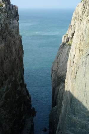
▲"One-Line Sky and the Martyred Maiden's Pit" are two geological sites located not far from each other. These two sites showcase different developmental stages of the same geological process, making them highly educational. (Photo / Courtesy of Taiwan Geopreservation Network)
The "A-Xq Yi Ancient Trail Coastline" in Pingtung’s Mudan Township belongs to the "Chaozhou Formation," which is widely distributed in the area north of Fenggang River on the Hengchun Peninsula. The landscape is characterized mainly by steep slopes and gravel beaches, with sea cliffs, coastal terraces, river terraces, and the river mouth gravel beach of Mokou River forming the estuarine landscape at the cape.Although it gained fame due to a road development controversy, the public often only associates it with being an ancient trail suitable for hiking, while overlooking the fact that the area boasts a remarkably rich, diverse, and unique geological and landform landscape. It has now been designated as a nature reserve by the county government for preservation. Visitors applying to enter should not forget to appreciate the beauty of this pristine coastal landscape while exploring and hiking.
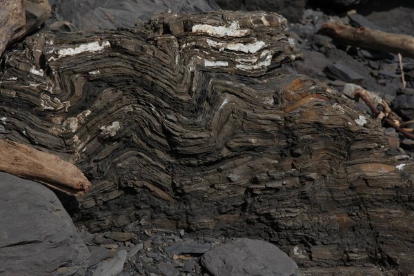
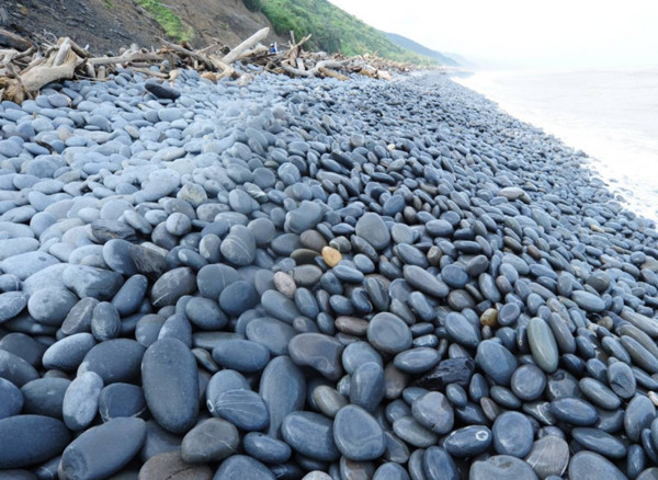
▲The A-Xq Yi Ancient Trail Coastline features the "Chaozhou Formation." Many people often overlook the area’s remarkably rich, diverse, and unique geological and landform landscape. (Photo / Courtesy of Taiwan Geopreservation Network)
Behind unfamiliar landscape names also lie extraordinary scientific and scenic values. The Forestry Bureau encourages everyone to take a closer look at the detailed information about each featured landscape before voting.detailed introduction materialsWith a deeper understanding, you might develop a different perspective when casting your vote.
Voting website>>>2013 Taiwan Top Ten Geological Landscapes Voting Campaign
Share
This article is published by HowToTrip. Sharing and reposting are welcome — please credit the source.
Article URL: https://www.howtotrip.net/views-26814
Related Articles
- Shaoxing's "Grandpa Gourd" hangs the gourds back up: "If there are too many people, we'll interact less — just take a quick look from afar"
- Chinese authorities announce "reciprocal adjustment" to Japan visa fees — single-entry visa jumps from 2,250 to 16,750 yen!
- 旅客携带的“保健石”核辐射超标千倍,同机人员或遭殃!海关提醒!
- 深圳机场深夜通报!出现不明升空物,航班大面积延误!
- “拆盒洗了才说要钱!”高铁200克葡萄卖60元,12306回应!
- 买不了机票?出境被拒?登机被拦?一大波中国游客莫名成了“失信人”
- 不利天气和经济波动影响哥伦比亚咖啡市场
- 海边浴场回应冲脚淡水收费2元/30秒:明码标价!
- 舱门没关好就起飞?机翼出现问题?多个航班途中紧急折返!
- 感受大自然的馈赠!盘点世界十大唯美海岸线