Mount Everest
Mount Everest

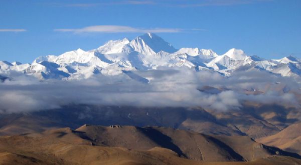
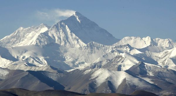
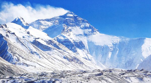
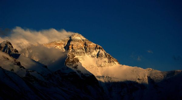
At the foot of Mount Everest lies the Rongbuk Monastery, the highest-altitude temple in the world. It is also the best vantage point to view Mount Everest, located just 25 kilometers in a straight line from the peak.
Mount Everest is a typical fault-block uplift mountain. Between its Precambrian metamorphic rock base and the overlying sedimentary rock layers lies a thrust fault zone, where early Paleozoic strata have been thrust southward over Proterozoic strata along this zone. The upper part of the peak consists of Early Ordovician or Cambro-Ordovician calcareous rock formations (with gray crystalline limestone at the summit), while the lower part comprises Cambrian argillaceous rock formations (such as phyllite and schist), along with intrusions of granite and migmatite dikes. The rock strata generally dip northeastward at a gentle angle. Since the end of marine transgression in the mid-Eocene, Mount Everest has been undergoing rapid uplift, rising approximately 3,000 meters from the late Pliocene to the present. Due to the ongoing collision of the Indian and Eurasian tectonic plates at a rate of 5.08 centimeters per year, the entire Himalayan range, including Mount Everest, continues to rise, with the peak growing by about 1.27 centimeters each year. The Everest region features well-developed valley glaciers, with numerous massive valley glaciers radiating outward from the mountain. There are 18 glaciers longer than 10 kilometers, extending down to elevations between 3,600 and 5,400 meters. Among these, the three major northern slope glaciers—Rongbuk Middle, Rongbuk West, and Rongbuk East—and their over 30 smaller tributary glaciers form the most prominent glacial complex. Within a 5,000-square-kilometer area around Mount Everest, glaciers cover approximately 1,600 square kilometers. Ice towers are commonly found in the ice tongues of many large glaciers. Ancient glacial landforms such as cirques, glacial trough valleys, glacial or fluvioglacial erosion and deposition platforms, lateral moraines, and terminal moraines are also frequently observed. Intense frost weathering has created rugged summit rocks, towering horns and arêtes, and extensive fields of scree or blockfields. Repeated freeze-thaw cycles near the surface have formed unique periglacial landforms such as stone rings and stone fences.
Time Required
4 days
Admission Fee
180 RMB
Opening Hours
Open all day
Location
Tingri County, Shigatse Region

Share
This article is published by HowToTrip. Sharing and reposting are welcome — please credit the source.
Article URL: https://www.howtotrip.net/travel-9572
Related Articles
- Shaoxing's "Grandpa Gourd" hangs the gourds back up: "If there are too many people, we'll interact less — just take a quick look from afar"
- Chinese authorities announce "reciprocal adjustment" to Japan visa fees — single-entry visa jumps from 2,250 to 16,750 yen!
- The "health stones" carried by a traveler were found to have radiation levels exceeding safety limits by a thousand times, potentially endangering fellow passengers on the same flight. Customs issues warning!
- Shenzhen Airport Issues Late-Night Notice: Unidentified Aerial Object Detected, Causing Widespread Flight Delays!
- “They only said it cost money after I opened the box and washed it!” 200g of grapes sold for 60 yuan on a high-speed train—12306 responds!
- Can't buy an airline ticket? Denied exit? Blocked from boarding? A large number of Chinese tourists have mysteriously become "discredited individuals"
- Adverse weather and economic fluctuations impact Colombia's coffee market
- Beach bathing area responds to 2 yuan/30 seconds fee for freshwater foot rinsing: Clearly priced!
- Taking off with an improperly closed cabin door? Wing malfunction? Multiple flights made emergency returns mid-journey!
- Experience the gifts of nature! A countdown of the world’s ten most stunning coastlines