Mali
A landlocked West African nation on the southern edge of the Sahara, renowned for the golden history of the Mali Empire, Timbuktu manuscripts, the Great Mosque of Djenné made of adobe, and Dogon mask culture.
Mali (Republic of Mali)
| Capital | Bamako |
|---|---|
| Continent | Africa |
| Languages | French, Bambara |
| Currency | West African CFA franc (XOF CFA) |
| Time Zone | UTC+0 (Greenwich Mean Time) |
| Dialling Code | +223 |
| Area / Population | 1.24 million square kilometers / Approximately 23 million |
| Visa | Most foreign visitors need a visa to enter Mali, which can be obtained from the nearest Malian embassy or consulate. Entry requires a valid passport, proof of yellow fever vaccination (yellow card), and a return or onward ticket. Safety advisories have been issued for northern areas such as Timbuktu, Gao, and Kidal, and travelers are advised to avoid these regions due to heightened risks. |
| Best Season | The dry season from November to February is relatively cool and the best time to travel; March to May is extremely hot, while June to October brings the rainy season to the south. The security situation in the north is severe, so travelers must assess risks before visiting. |
| Main Cities | Bamako, Ségou, Mopti, Djenné, Bandiagara, Dogon Region, Timbuktu (high risk, advised to avoid) |
Mali in Detail
Overview of Mali
Mali is a landlocked country in West Africa, located on the southern edge of the Sahara Desert. It borders Algeria to the north, Niger to the east, Burkina Faso and Côte d'Ivoire to the south, Guinea to the southwest, and Senegal and Mauritania to the west. With a land area of approximately 1.24 million square kilometers, it is one of the largest countries in West Africa. The capital, Bamako, is situated on the banks of the Niger River in the southwest and serves as the country’s political, economic, and cultural center. The official language is French, and Bambara is the most widely spoken lingua franca.
Mali was once at the heart of the three great medieval West African empires (Ghana, Mali, and Songhai), with Timbuktu (also known as Tombouctou) serving as a major hub of Islamic scholarship and trade. Today, Mali’s economy relies mainly on agriculture and gold exports, but it faces challenges such as a precarious security situation in the north and underdeveloped infrastructure. Travelers should be fully aware of the security environment.
Geography and Climate
Mali can be divided into three main geographic zones from north to south: the northern region consists of the Sahara Desert and adjacent arid plains, including towns like Timbuktu, Gao, and Kidal; the central zone is the Sahel semi-arid belt, an area of pastoralism and cultivation of millet and sorghum; the southern zone is the Sudanian savanna, with higher rainfall and important production of cotton, rice, and peanuts. The Niger River flows from west to east through the southern part of the country, forming the Inner Niger Delta near Mopti, a vast network of wetlands that is a key area for migratory birds and fisheries in West Africa.
The climate is tropical and hot year-round. The period from November to February is the cooler dry season, with cooler nights, making it the best time to travel. From March to May, the heat is intense, with temperatures often exceeding 40°C. The rainy season lasts from June to October, with concentrated rainfall in the south, while the north remains dry. In the dry season, the north is often affected by the Harmattan winds, bringing dusty conditions.
Historical Background
From the 8th century onward, the Ghana Empire rose in West Africa, controlling trans-Saharan trade in gold and salt. In the 13th century, Sundiata Keita founded the Mali Empire, whose territory spanned much of present-day Mali and surrounding regions, making it one of the wealthiest empires of its time. In the 14th century, Mansa Musa’s legendary pilgrimage to Mecca, during which he was said to have distributed gold along the way, spread the fame of Mali across the Arab and European worlds. At its peak, Timbuktu attracted scholars from across the Islamic world, and institutions like the Sankoré Mosque became renowned centers of learning, with manuscripts still preserved today.
By the late 15th century, the Songhai Empire replaced the Mali Empire and continued to dominate regional trade until its defeat by Moroccan forces in 1591. West Africa then entered a period of fragmentation. By the late 19th century, France gradually occupied the region, incorporating it into French Sudan. In 1959, it formed the short-lived Mali Federation with Senegal, and the Republic of Mali gained full independence in 1960. Since 2012, armed conflict has erupted in the north, leading to ongoing security tensions that are a primary consideration for travel planning.
Economy and Currency
Mali’s economy is predominantly agricultural. Cotton is the most important cash crop and export, alongside the cultivation of rice, millet, maize, and peanuts. Livestock farming plays a significant role in the north and central regions. In terms of mining, Mali is a major gold producer in Africa, and gold exports are the primary source of foreign exchange. The industrial base is weak, with many manufactured goods relying on imports. The national currency is the West African CFA franc (XOF), issued by the Central Bank of West African States (BCEAO), and its value has been pegged to the euro, contributing to relative stability.
Culture and Society
Mali is a cultural hub of West Africa, home to various ethnic groups including the Bambara, Fulani, Songhai, Tuareg, and Dogon. The Dogon people, residing in the Bandiagara Escarpment area, are known for their unique village architecture, woodcarvings, mask dances, and astronomical knowledge. Their mask dances were inscribed on UNESCO’s Intangible Cultural Heritage list in 2008. Mali also has a rich musical tradition, with instruments like the kora and ngoni, and artists such as Salif Keita, earning it the reputation as the heart of West African music.
The Great Mosque of Djenné, the world’s largest adobe structure, is a key landmark. The annual plastering ceremony before the rainy season is a major community event. Timbuktu houses three historic mosques and a large collection of ancient manuscripts, all recognized as World Heritage Sites. The local diet features millet, rice, and couscous, often accompanied by peanut sauce stews, fish soup, and grilled meat. Green tea, served in the traditional three-course West African style, is a common hospitality ritual.
Tourism Overview
The highlights of travel in Mali are concentrated in the southern and central regions: the Niger River scenery and craft markets in Bamako, the riverside and pottery traditions of Ségou, the fishing port and Inner Niger Delta around Mopti, the adobe Great Mosque of Djenné, and the cliff villages and mask culture of the Dogon Region—all offering significant cultural and photographic value.
It is important to note that the security situation in northern and some central parts of Mali is highly unstable. Travelers are advised to avoid areas such as Timbuktu, Gao, Kidal, and certain border zones due to elevated risks. If visiting Mali, it is recommended to stay in more stable southern cities, monitor the latest travel advisories closely, obtain comprehensive travel insurance that includes emergency evacuation, and avoid travel at night or to remote areas. Local infrastructure and medical services are limited, so careful trip planning is advised in consultation with travel insurance providers and official advisory sources.
Local Currency: West African CFA franc (XOF)
Currency Overview
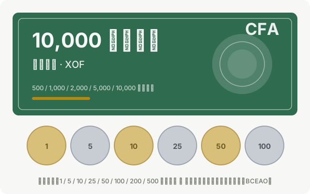
The official currency of Mali is the West African CFA franc (currency code XOF, often written as CFA), issued by the Central Bank of West African States (BCEAO). It circulates in eight countries within the West African Economic and Monetary Union, including Mali. The West African CFA franc is pegged to the euro at a fixed exchange rate (1 euro ≈ 655.957 CFA francs), making it more stable compared to other West African currencies. Mali does not issue its own banknotes; the CFA franc circulating in Mali is the same as in other member states.
Denomination System
CFA franc banknotes in circulation come in denominations of 500, 1,000, 2,000, 5,000, and 10,000 francs. Notes of 5,000 and 10,000 francs are often blue and purple, while 1,000 and 2,000 francs tend to be reddish-brown, and 500 francs are the smallest. Coins are issued in denominations of 1, 5, 10, 25, 50, 100, 200, 250, and 500 francs. Due to the small value of coins and inconvenience in carrying them, paper money is the main medium of exchange. The CFA franc has no smaller subdivision units, and prices are typically quoted in multiples of 5 francs. Transactions often settle in round hundreds, with minor price fluctuations on small items.
Cash and Payment Habits
Cash is the primary means of payment in Mali. Card acceptance is limited, generally restricted to certain hotels, banks, and foreign-affiliated shops in Bamako. Mobile payments and local e-wallets are not easily accessible to tourists. Markets, taxis, minibuses, street food vendors, and craft stalls only accept cash, and small change can be scarce. It is advisable to carry small-denomination bills. U.S. dollars and euros can be exchanged for CFA francs at Bamako airport, banks, and authorized exchange offices, with banks generally offering better rates. Always count cash in person when exchanging with private individuals. Due to the high denominations of banknotes, it is wise to split large bills and exchange higher denominations (above 5,000 francs) for smaller ones to facilitate everyday transactions like transport and small purchases.
Traveler Tips
- It is recommended to carry euro or U.S. dollar cash and exchange it at authorized banks or exchange offices, avoiding carrying large amounts of cash.
- The CFA franc is fixed to the euro; as a rough guide, 1,000 francs is approximately 1.5 euros.
- Credit card usage is limited in Mali. Carry sufficient cash in Bamako and confirm ATM availability before traveling to other regions.
- Unused CFA francs can be exchanged back at the airport before departure, but the currency is not valid outside member states, so plan your cash usage accordingly.
Flag Meaning
Flag Design
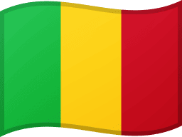
The flag of Mali is a vertical tricolor consisting of three equal horizontal bands of green, yellow, and red, in that order from left to right, with a ratio of 2:3. The colors are of equal size and arranged vertically, creating a bold visual impact. This vertical design ensures the flag remains clearly visible even when there is little wind, making it prominent when hung at government buildings or on streets. Originally, during the early years of Mali’s independence, the yellow band featured a black human stick figure (Kanaga) at its center, symbolizing humanity, but this was removed in 1961, leaving just the three solid colors.
Meaning
Green represents the fertility of the land and agriculture, as well as reflecting Islamic tradition. Yellow symbolizes the country’s wealth and mineral resources. Red stands for the blood of those who sacrificed for independence and the spirit of struggle. These colors follow the broader Pan-African color scheme, aligning with Mali’s historical and regional identity, and expressing aspirations for prosperity and unity.
History and Legal Status
During the 1959–1960 period of the Mali Federation, the flag featured the black Kanaga figure on the yellow band, symbolizing human solidarity and strength. After the federation dissolved and the Republic of Mali became independent, the central emblem was removed in 1961 to distinguish the flag from those of neighboring countries, resulting in the current plain tricolor design. This change also reflected Mali’s pursuit of simplicity and national unity. Though devoid of additional emblems, the bold green-yellow-red vertical stripes make the Malian flag distinctive among African nations. Today, the flag is widely displayed on Independence Day, at government buildings, and during sporting events. Its colors are also commonly featured in clothing, textiles, and souvenirs.
Mali Travel Guide
All Guides »Mali Pre-Travel Guide: Visa, Safety, Best Seasons & Budget Reference
Before traveling to Mali, carefully review its visa requirements, security situa...
7-Day Southern Mali Cultural Route: Bamako – Ségou – Mopti – Djenné – Dogon Country 7 days
Focusing on safe areas in the south, this route connects the Niger River, mud-br...
4-Day Short Trip in Mali: Bamako and Ségou Along the Niger River 4 Days
Stay in southern cities for four days to experience the Niger River, handicraft ...
Must-visit attractions in Mali: Bamako, Djenné, Dogon Country, and Mopti
Focus on must-see destinations in southern Mali’s safer regions — from mud-brick...
A Guide to Malian Cuisine: Millet Balls, Peanut Sauce Stews, and West African Three-Course Tea
Malian cuisine, based on millet, rice, and river fish, paired with the essential...
Travel Guide to Transportation in Mali: Sénou Airport, City Taxis, and Intercity Private Transfers
Private transfers from Bamako Airport to southern cities, as well as river trans...
10 Practical Travel Tips for Mali: Safety, Health Precautions, and Cash Preparation
Start with safety advisories for the north, then consider health measures, payme...