Explore the shallow mountain landscapes of Meinong and Qishan, and admire the breathtaking aerial views of Greater Kaohsiung captured by Chi Po-lin
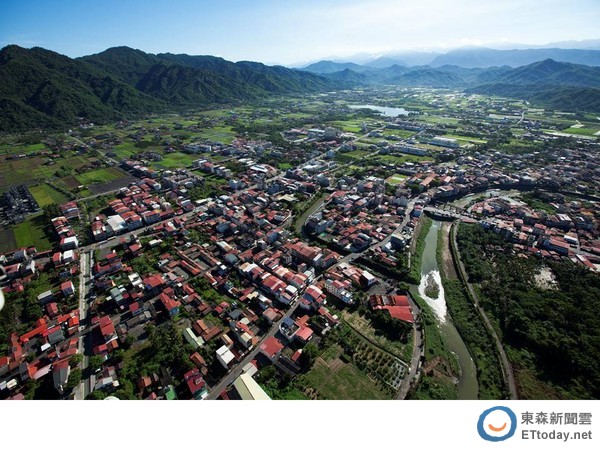
▲ Renowned aerial photographer Chi Po-lin captures Meinong from the air. (Photo / Provided by Kaohsiung City Urban Development Bureau)
More breathtaking aerial views of Kaohsiung<<<<<<<<
Travel Center / Comprehensive Report
So beautiful!The Kaohsiung City Urban Development Bureau commissioned renowned domestic aerial photographer Chi Po-lin to capture aerial footage of the shallow mountain landscapes in areas such as Meinong and Qishan. The aerial shots of Meinong reveal a place surrounded by mountains on three sides, where red settlements and green fields intertwine like a beautiful painting. In addition, the Urban Development Bureau has conducted aerial photography of various scenic spots across Greater Kaohsiung in recent years, including representative sites such as the Moon World, Qijin sea area, Love River, and Kaohsiung Harbor.
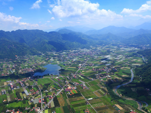
▲ Aerial view of Meinong settlements and Zhongzheng Lake, commissioned by the Kaohsiung City Government. (Photo / Sourced from the Kaohsiung City Urban Development Bureau website)
Chi Po-lin said that Meinong is located between the metropolitan area of Kaohsiung and the mountainous region. Viewed from the air, the town is embraced by mountains on three sides, away from the hustle and bustle, and its beauty is otherworldly. The Urban Development Bureau pointed out that Meinong has been selected as one of Taiwan’s Top 10 Small Tourist Towns, and it also preserves the most complete Hakka settlement in the country, making it one of the most representative areas of Hakka culture. Recently, efforts have also been made to promote the conservation of resources in the Huangdie Green Valley and to actively seek the designation of Meinong as a national nature park.
In addition to the impressive aerial shots of Meinong, the Urban Development Bureau has in recent years also commissioned aerial photography of various natural landscapes, settlements, architecture, industries, and transportation sites across Greater Kaohsiung. For natural landscapes, the categories include mountains, sea, rivers, and harbors; settlements are divided into old town districts and new town districts; and architecture includes both significant buildings and nostalgic structures.
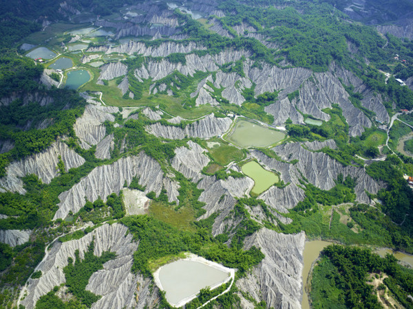
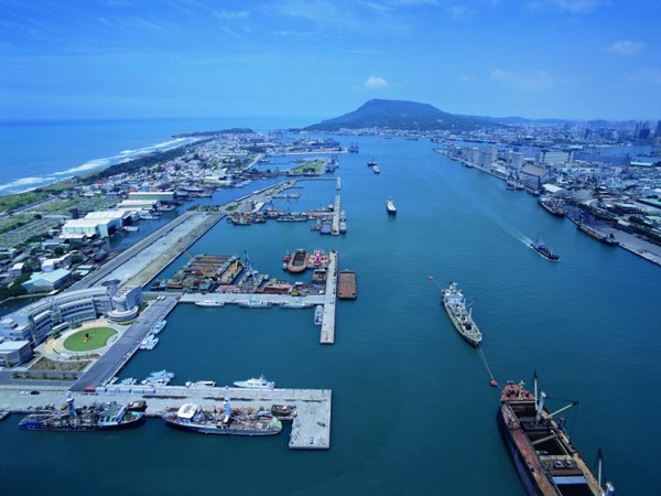
▲ Aerial views of the Moon World badlands (left) and Kaohsiung Harbor’s main channel (right), commissioned by the Kaohsiung City Government. (Photo / Sourced from the Kaohsiung City Urban Development Bureau website)
Representative natural landscapes include the Moon World badlands, Qieding Coast, Meinong Zhongzheng Lake, and the Heart of Love River. Important buildings featured include the Chengcing Lake Baseball Stadium, Kaohsiung Harbor, and Hongmaogang. Through these aerial photographs, the public can gain a fresh perspective on Kaohsiung and appreciate the unique beauty of Greater Kaohsiung.
Share
This article is published by HowToTrip. Sharing and reposting are welcome — please credit the source.
Article URL: https://www.howtotrip.net/views-27028
Related Articles
- Shaoxing's "Grandpa Gourd" hangs the gourds back up: "If there are too many people, we'll interact less — just take a quick look from afar"
- Chinese authorities announce "reciprocal adjustment" to Japan visa fees — single-entry visa jumps from 2,250 to 16,750 yen!
- The "health stones" carried by a traveler were found to have radiation levels exceeding safety limits by a thousand times, potentially endangering fellow passengers on the same flight. Customs issues warning!
- Shenzhen Airport Issues Late-Night Notice: Unidentified Aerial Object Detected, Causing Widespread Flight Delays!
- “They only said it cost money after I opened the box and washed it!” 200g of grapes sold for 60 yuan on a high-speed train—12306 responds!
- Can't buy an airline ticket? Denied exit? Blocked from boarding? A large number of Chinese tourists have mysteriously become "discredited individuals"
- Adverse weather and economic fluctuations impact Colombia's coffee market
- Beach bathing area responds to 2 yuan/30 seconds fee for freshwater foot rinsing: Clearly priced!
- Taking off with an improperly closed cabin door? Wing malfunction? Multiple flights made emergency returns mid-journey!
- Experience the gifts of nature! A countdown of the world’s ten most stunning coastlines